
project ref : 002
location : A’ Sithean Donn (Sìdhean Donn), Gairloch
grid ref : centred on NG 812 788
category : multi-period complex site
features : roundhouses, field system, fank, walls, banks & dykes

A’ Sithean Donn
This complex series of enclosures and walls curves around the low hill, Sìdhean Donn (OS map). It is bounded by A’ Loch Feòir (Loch Feur) in the south and a small reedy lochan to the north, Lochan Dubh na Cuilc.

The sheepfold (fank) within its enclosure, is the focal point for this complex site.

Some of the boundaries are very difficult to see on the ground, as they are probably faint remains of prehistoric walls & dykes.
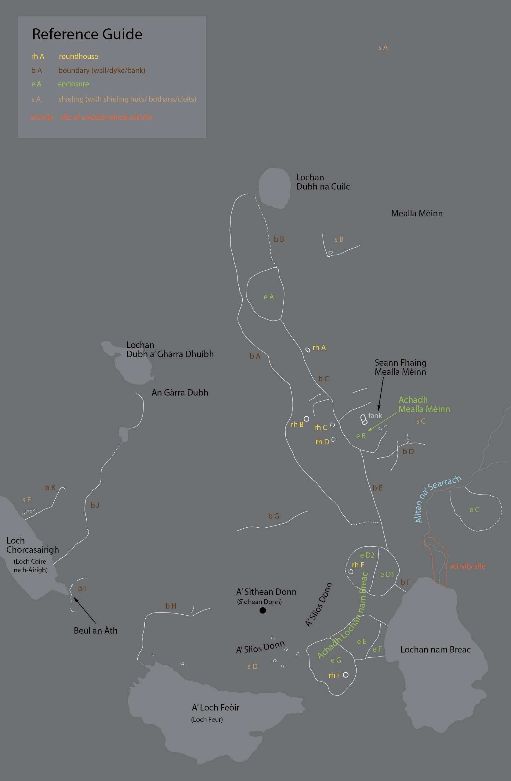
Reference guide [rh roundhouse, b boundary, e enclosure, s shieling]
s A shieling ground just north-east of Lochan Dubh na Cuilc (small reedy loch)
b A, D, G, H, I, J prehistoric boundaries, often very faint & difficult to follow
e C prehistoric enclosure with extremely faint boundary dyke
e D1 & e D2 originally one large circular enclosure
rh A unusual shaped roundhouse (construction altered)
rh B substantial roundhouse with typical double skinned wall structure
rh C possible roundhouse (rearanged)
rh D possible roundhouse (rearanged)
rh E rearanged roundhouse
rh F vague but conclusive remains of roundhouse

Activity site, where the burn flows into the north side of Lochan nam Breac,
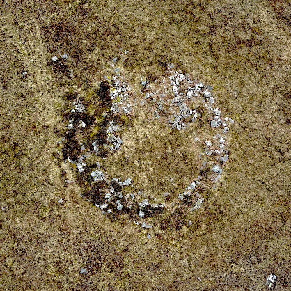
Roundhouse remains (rh B)

Lochan Dubh na Cuilc (small reedy lochan) at north end of site

Roundhouse remains (rh A)

Faint traces of ancient wall/dyke (b H)